Rain will hit SoCal for much of this week. Why it’s probably not a fire killer

- Share via
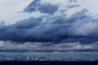
Back-to-back atmospheric river storms are set to hit Los Angeles County this week — giving the region much-needed moisture ahead of another potential round of Santa Ana winds.
Forecasters are optimistic the coming rain will be primarily beneficial for Southern California, reinvigorating vegetation left vulnerable by a historically dry start to the water year without unleashing devastating mudslides in recently burned areas.
The National Weather Service estimates there’s less than a 5% chance of significant debris flow in fire-scorched parts of Los Angeles and Ventura counties. That can still change, however, especially if the second storm strengthens or changes its path of approach later this week.
Still, officials are preparing for possible danger near L.A. County burn scars.
The California Department of Transportation plans to close a stretch of Pacific Coast Highway from Chautauqua Boulevard, in Los Angeles, to Carbon Beach Terrace, in Malibu, on Tuesday at 3 p.m. because of the risk of debris flows. The scenic highway had fully reopened Monday morning after a weeks-long closure during the Palisades fire.
Despite the closure, Palisades residents with appropriate passes will be able to access their homes using Chautauqua Boulevard, according to Caltrans.
“Out of an abundance of caution, the highway must be closed due to soft soils on both the hill and ocean sides of the road. Mud and debris flows may occur and canyons may overtop, blocking the road or causing further damage,” the agency wrote in a news release.
The series of atmospheric rivers — the first of which arrived in Northern California on Friday — hit the San Francisco Bay Area harder than expected. The northern portion of the state is expected to see three storms this week.
By Tuesday morning, there were several reports of landslides across the North Bay, with urban and stream flooding. The Russian River in Guerneville is forecast to reach minor flood stage early Wednesday.
Forecasters expected strong winds from the south and an increasing chance of thunderstorms in the Bay Area, especially for areas east and south of San Francisco. Because of that, there’s an outside chance that storms may start rotating, “and, while unlikely, a land-falling waterspout or weak tornado cannot be ruled out,” the weather service said.
Todd Hall, a meteorologist with the weather service’s Oxnard office, said forecasters are hopeful the two storms might bring enough moisture to end the fire season. But it may not beat back fire danger immediately.
A stronger atmospheric river is set to hit Northern California on Monday and then hit L.A. County on Tuesday, aiding hopes of helping end a devastating fire season.
It typically takes three to six weeks for vegetation such as chaparral and coastal sage to soak up moisture from rainfall, Hall said.
“We’re still seeing that ... the fuel still could be susceptible, because it takes a while for the rainfall to soak in the soil and get into the native vegetation,” Hall said.
Even so, last month’s storm has already made a difference. Data indicate that vegetation has absorbed plenty of moisture, according to Alex Tardy, a meteorologist with the weather service’s San Diego office.
“As long as it stays cool, and we don’t have additional Santa Ana winds and get a little bit of precipitation like we’re going to see this week — that buys us time in February,” Tardy said. “A little bit of rain and snow goes a long way in the middle of the winter.”
Downtown Los Angeles received 0.54 of an inch of rain Jan. 25 through Jan. 27, and it’s possible downtown could get another four-fifths of an inch of rain through Friday.
Lawmakers are calling on the state to expedite rules for ember-resistant defensible space zones around homes that some experts say may have helped mitigate the damage from Los Angeles’ devastating wildfires.
Even if that happens, that total would still be short of the widespread 2 to 4 inches of rain meteorologists say are necessary to comfortably and definitively call an end to the fire season.
Another Santa Ana wind event could come by weekend
Every bit will help, though, especially with another moderate Santa Ana wind event possibly on the horizon over the weekend.
The winds could start from inland areas to the north, potentially affecting the Grapevine section of Interstate 5 and southern Santa Barbara County, before turning into a moderate Santa Ana wind event later in the weekend, Hall said.
Santa Ana winds bring in dry gusts, flowing from the high desert over mountains and through canyons, drying out vegetation as the cold air descends from an area of high pressure and compresses and warms up as it seeks areas of lower pressure by the coast.
Those dry gusty Santa Ana winds are capable of increasing fire risk — especially if combined with dry vegetation.
And despite the recent rain, much of Southern California is still dry, having received less than 25% of the typical rainfall for this point in the season. Santa Ana wind season can last through March.
Toxic chemicals from L.A.’s fires are going underreported and pose serious long-term risks, a group of lawmakers says. They want the EPA to create a task force.
Still far behind on rainfall this season
Many communities are still running well behind their typical annual rainfall. The droplet deficit is anywhere from 5 to 8 inches across a swath of Southern California, Tardy said.
Downtown L.A. has received just seven-tenths of an inch of rain since the water year began on Oct. 1 — just 9% of its typical average by this time of year.
San Diego has received just 0.35 of an inch, a record low start to the water year since regional record-keeping began in 1850. It’s also just 7% of the average for this point of the season.
The rain deficit for San Diego is about 5 inches: “That’s half of our annual rainfall that is missing,” Tardy said. And downtown Los Angeles’ deficit is nearly 7 inches — also nearly half of its average yearly rainfall.
The big question is what February — traditionally “our wettest month in California” — will bring, Tardy said.
The Trump administration abruptly sent water flowing from two California dams. The action could leave less water in dams for the summer, when farmers typically use it.
Possible dry weeks ahead
There’s a possibility that dry conditions will return later this month.
“Overall, we keep cold air,” Tardy said. “So, cold air really just becomes dominant across the northern United States really, from the Pacific Northwest all the way to New England.”
As a result, the jet stream — the fast current of air that moves from west to east — won’t be over Southern California. To get more rain, Southern California would like to be under the jet stream and have a chance to grab the moisture it ferries, according to Tardy.
The latest forecast models suggest the jet stream will instead go over Washington and Oregon, then descend to the southeast over Nevada and Arizona.

“That means we get on the dry side, which could even give us a little bit of offshore Santa Ana wind,” Tardy said. “It certainly doesn’t give us much of a chance for getting precipitation, but it does keep the temperatures cool and cooler than average for the second week of February.”
In other words, it’s “not looking promising for precipitation down here,” he said.
There is, however, a potential storm system developing in the Pacific Ocean, which possibly could arrive by mid-February, Tardy said. Still, that’s “not much opportunity for precipitation of any significance coming up.”
California’s snowpack stands at 65% of average for this time of year. After a dry January, major storms are forecast to bring more rain and snow.
This week’s forecast
The first of two atmospheric river storms is set to peak in Los Angeles and Ventura counties Tuesday night and last through Wednesday midday, with the second storm expected starting Thursday night into Friday morning.
“We’re most likely just seeing a light-to-moderate rain amounts and rain rates with minor impacts,” Hall said.
Both storms are of the “Pineapple Express” variety, so named because they carry tropical moisture from the ocean near Hawaii to the mainland.
During the first storm, peak rainfall rates could be light — between one-tenth of an inch per hour to one-quarter of an inch per hour. In Ventura, Santa Barbara and San Luis Obispo counties, peak rain rates could be moderate — between one-quarter of an inch per hour to one-half of an inch per hour, although there could be isolated locations of up to three-quarters of an inch per hour.
The key threshold for rainfall rates that can trigger significant debris flow is one half of an inch per hour or greater.
More rain could finally end Southern California’s fire season as Pacific Coast Highway is open for the first time in weeks.
There is a 10% to 20% chance that rainfall rates could get up to two-thirds of an inch per hour over the burn area of the 2024 Lake fire, which scorched 38,664 acres in the Santa Barbara County mountains north of Los Olivos.
There is a moderate chance — 30% to 40% — of rainfall rates around three-fifths of an inch per hour to three-quarters of an inch per hour across San Luis Obispo County.
Rainfall has the potential to be particularly focused on south-facing mountain slopes and hillsides, because of the path of the moisture arriving in the region, Hall said.
At the moment, there is a low chance of significant mud and debris flows in areas near the Palisades and Eaton fires, Hall said.
In L.A. County, the biggest rain-related impacts are likely to be minor creek and roadway flooding.
A deep analysis of the Palisades fire evacuation paints a chaotic scenario: As the fire roared toward homes, major escape routes were gridlocked before the first evacuation orders were given.
The most likely scenario for L.A. County’s first storm is peak rainfall arriving between 10 p.m. Tuesday through Wednesday midday. Long Beach and Covina could get one-quarter of an inch of rain; Santa Clarita, about one-third of an inch; and downtown L.A., Redondo Beach and Canoga Park, about two-fifths of an inch.

Rainfall totals will likely be higher to the north and west. In Ventura County, Thousand Oaks could get half an inch of rain; Fillmore, three-quarters of an inch; Oxnard, four-fifths of an inch; and Ojai, 1.64 inches. Santa Barbara could get 1.19 inches; San Luis Obispo, 1.47 inches; and Cambria, 1.96 inches.
For the second storm, the most likely scenario is peak rainfall on Thursday afternoon and evening. Long Beach, Redondo Beach, Santa Clarita, and Thousand Oaks could get about one-third of an inch of rain; downtown L.A., Oxnard and Canoga Park, two-fifths of an inch; Covina, half an inch; and Santa Barbara, three-fifths of an inch.

Snow levels will remain above 6,500 feet to 8,000 feet above sea level in L.A. County.
Winds from the south and southwest are expected to develop over the next several days. L.A. County could see peak gusts of between 15 mph to 25 mph in highly populated areas, and between 25 mph to 45 mph in the mountains and deserts.
More to Read
Sign up for Essential California
The most important California stories and recommendations in your inbox every morning.
You may occasionally receive promotional content from the Los Angeles Times.


